Doug Corrin
Forestry Department
Home FRST 121 FRST 132 Measures FRST 328 FRST 351 FRST 352 FRST. Dept.
FRST 121
Welcome
Lecture
Terms & Concepts
Other Links
Help with the Math
Hints for exams
FRST 121 - Maps & Photogrammetry
Lectures
Jump to topic:
Intro to Maps
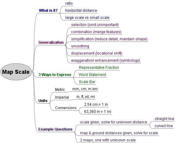
Units, Map Scale & Distance Calculations
Area
Graticule & Datum
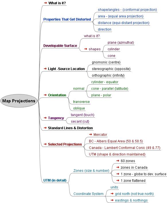
Map Projections
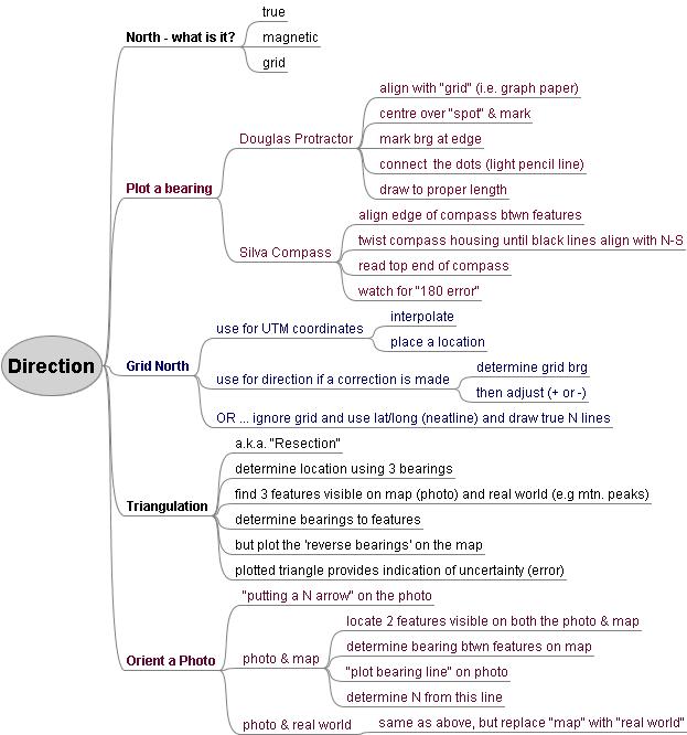
Orienteering
Coordinates (Where am I?)
Air Photos (Remote Sensing)
Air Photo Geometry
LiDAR
Satellite Imagery
GPS Basics
Photo Interpretation
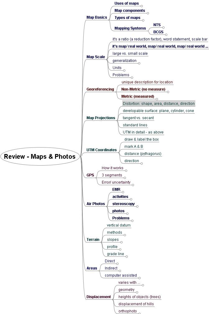
Review
GIS - optional
Lecture Outlines
Helpful Sites
Map Basics - Prezi
Map Basics Prezi - pdf
Map Basics - old outline
Map Basics - Backpacker's Guide (1)
Reading Topographic Maps - a comprehensive guide
Google Maps - YouTube
NTS Maps of BC - to order paper maps
GeoBC - can download to computer or iPad
Map Scale - outline
Map Scale - jpg
Practice Questions on Scale - extra practice for the keen
Scale & Distance - from Reading Topographic Maps
Unit Conversions - metric - imperial conversions
Area - Prezi
Area Prezi PDF
Area - Freemind
Help with Area
Georeferencing - outline
Datum supplemental reading
Datum Overview
Lat/Long diagram
Longitude & Time Zones a Cdn idea
NAD 27-83 Converter (83-->27: 49.1642, 123.9364)
Coord Converter (dms, d.d, d m.m, UTM)
Map Projections - outline
Map Projections - jpg
Mercator App - way cool
Map Projections - quick overview
Albers Equal-Area Projection - wikipedia
UTM Zones of Canada
Direction - outline
Direction - jpg
Using a map & compass - Backpacker's Guide
Navigation - pdf
Where am I? - Prezi
Where Am I? - pdf
Interpolating Coordinates - old notes
Example on map
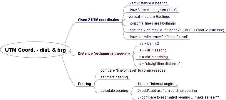
UTM direction & dist.
UTM direction & dist. - jpg
UTM direction/dist. - pdf
Terrain
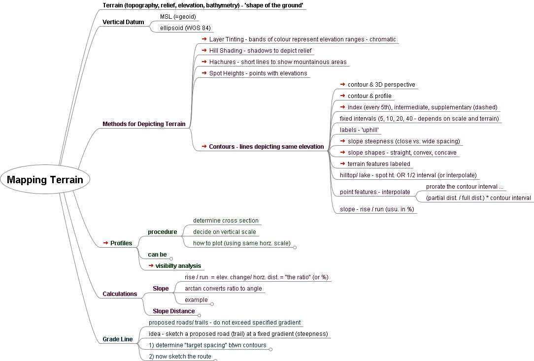
Mapping Terrain - lecture outline
Mapping Terrain - jpg
Help with Slope (SD-HD-elev)
Terrain pdf
Visualizing Topography - click through the various 'steps' at the bottom of the page - note that each page has a couple of 'interactive buttons'
3D Map Viewer - EarthDetails.com - try typing Mount Albert Edward, BC in the search box
Elevation & Relief - from Reading Topographic Maps
Air Photos
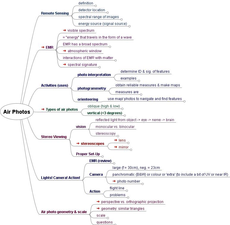
Air Photos Intro - outline
Air Photos - old notes
Air Photos - jpg
EMR & atmospheric window
Remote Sensing - Physical Geography text - chapter 2
Aerial Photographs - from Reading Topographic Maps
Map & Air Photo Orders for BC
1. click "Air Photos",
2. zoom into an area,
3. click "Search for air photos" button
Air Photo Geometry (Horiz. Distance)
Air Photos Geometry - outline
Air Photo Geometry - diagram
Perspective-Orthographic - diagram
Photo Scale f & H - diagram
Basic Image - f / H (H = AGL)
Basic Image - pd / GD
Air Photo Geometry - pdf (old)
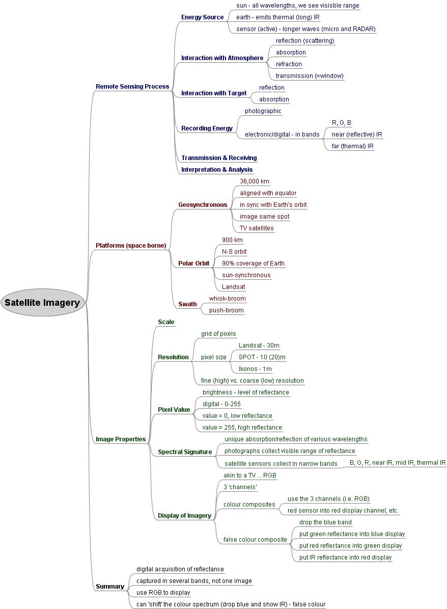
Satellite Imagery - lecture outline
Satellite Imagery - jpg
Assignment
Natural Resources Canada - Remote Sensing
Introduction
EMR
EMR spectrum
Atmospheric interactions
Target interactions
Passive vs. active
EMR & Atmosphere - from PhysicalGeography.net
Satellite Orbits
Color Generator - try combining RGB to make different colours
YouTube Clips
satellites good - good overview
satellites - clip about TV satellites (Astra in Europe)
geosynchronous orbit - simple animation
polar orbit - animation, takes time to load
both orbits - click all 9 steps - cool
landsat - shows polar orbit and whisk-broom scanning
landsat7 - 7 bands of EMR captured
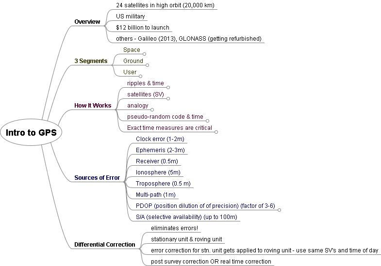
GPS - lecture outline
GPS - jpeg
How GPS Works
- pdf
Trimble - What is GPS? - excellent description in easy to understand language!
Garmin - What is GPS?
video 1
video 2
Air Photos Viewing - outline
7 Elements Photo Interp - pdf
GIS - Prezi
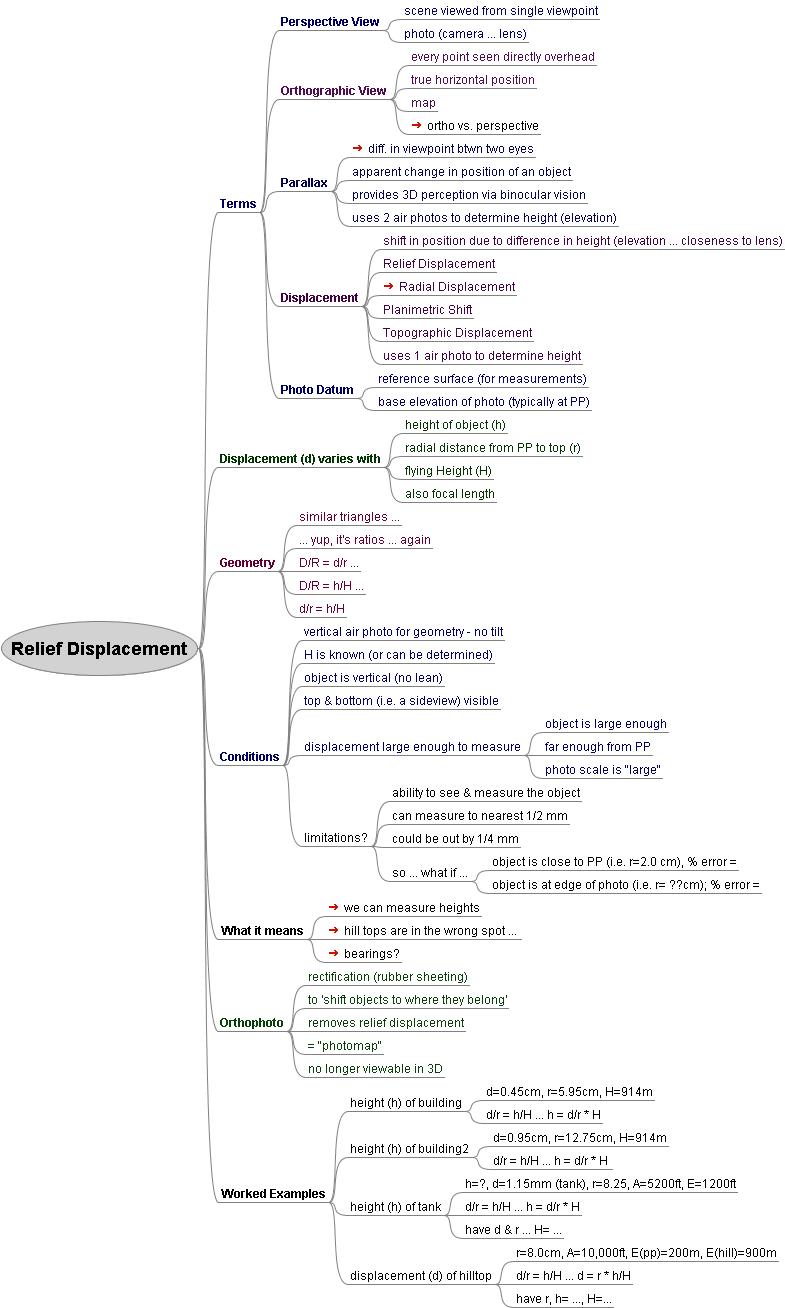
Air Photo - Relief Displacement
Relief Displacement - outline
Relief Displacement - mind map
Relief Displacement - triangles diagram
Relief Displacement - measures diagram
Air Photos 101 - Basics - from Natural Resources Canada
Air Photos 101 - Photo Interpretation - from Natural Resources Canada
Mind Map