Introduction
to Aerial Photos
Remote Sensing –
detailed description
- observation/ measurement of object(s) without touching
- use of EMR to record images of the environment (surface of the earth)
- images are used for interpretation (ID and significance), measurement, map making & orienteering/navigation
Platforms - aircraft or satellite
Signal Source
passive - record naturally generated energy (light/heat) - e.g. a camera
active - transmits and receives "bounced" energy (e.g. RADAR)
Image Types
air photos (oblique or vertical) - broadband (many wavelengths into one image)
multi-spectral satellite images - record images in separate wavelength bands (RGB, & near, mid and far IR) then combine into one image
narrow band - RADAR
Oblique vs. Vertical Air Photos
Uses of Air Photos
·
Orienteering
·
Photo Interpretation
· Photogrammetry (measures & map making) - The science or art of obtaining measurements or producing contour maps directly from aerial photographs or other remotely sensed imagery. Also, the determination of surface coordinates in a 3-dimensional coordinate system.
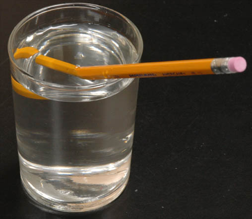
Basics of Stereo Viewing
·
Vision:
Monocular vs. Binocular
·
Stereoscopic Vision
o
Definition
o
Conditions
·
Stereoscopes
Lights, Action, Camera!
Lights
Travel
Action
(a.k.a. take the pictures
Camera:
wow, that’s big
Orienting Photos for Stereo Viewing
Select adjacent photos
Locate PP’s & CPP’s (hey, what’s a “PP”?)
(Orient shadows)
Align photos with a straight edge
Set stereoscope along flight line
Adjust photos for (inter-pupil) distance
can measure heights of features
"tops" (including hilltops) are in the wrong spot!
Some Terms
ENDLAP: The overlap of aerial or space photographs or images along the flightline - about 60% - allows for stereo viewing
SIDELAP: The area common to two photos in adjacent flight strips - about 20-30% - ensures complete coverage (no gaps)
DRIFT: The horizontal displacement of the aircraft, caused by the wind, from the intended path - caused by side wind
CRAB: Turning of an airplane (into the wind to counteract drift) which causes its longitudinal axis to vary from the track of the plane - thus plane is "angled" but flies along the intended path
FIDUCIAL MARKS: Index marks (usually 4) found on most optical imagery. The marks are adjusted so that the intersection of lines drawn between opposite fiducial marks defines the principal point.
PRINCIPAL POINT (PP): This is the geometric center of a photograph.
CONJUGATE PRINCIPAL POINT (CPP): The location of the PP from an adjacent photo.
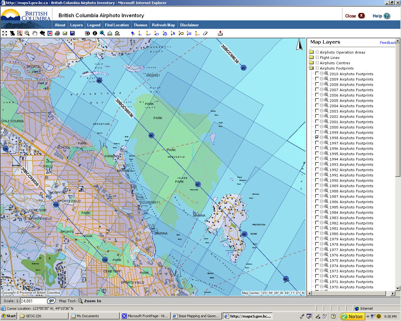
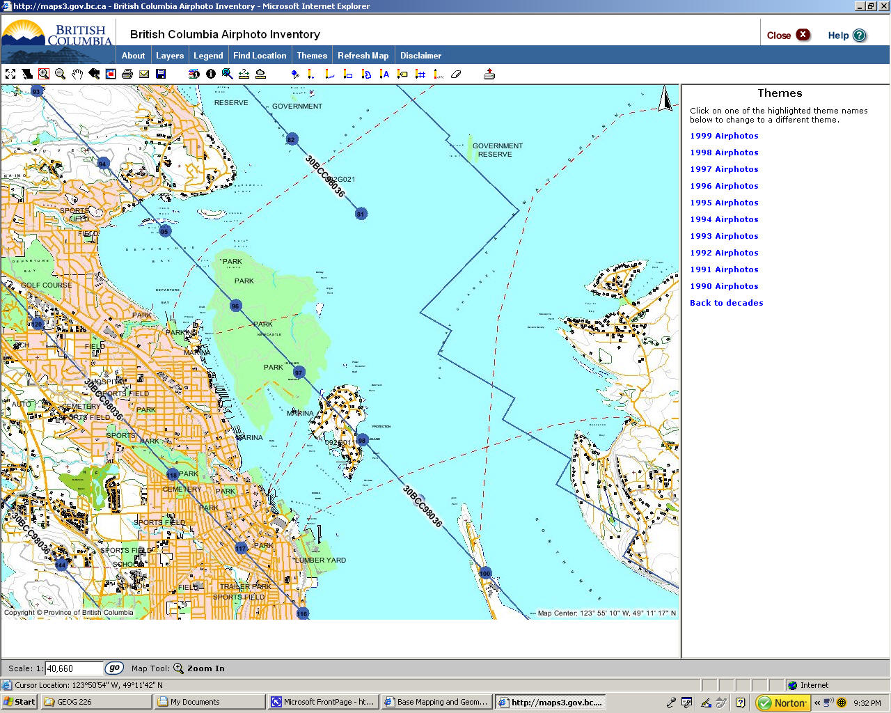
Photo lines (from
BC Airphoto
Inventory)
Air Photo Index (with photo centers) - from "BC Airphoto Inventory" Ministry of Sustainable Resource Management
Air Photo Index (with photo foot prints) from “Make a Map” Ministry of Sustainable Resource Management