 |
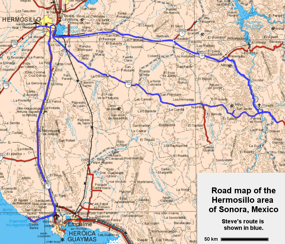
Steve's route is shown in blue. Some of the place-names given below are shown. |  |
| Road map of the Hermosillo area and geology map of Mexico (click on the maps to see more detail) |
|
|||||
| Click on any one of the images below to see a larger version |
|
|||||
| Some views of the Hermosillo area and inside the courtyard of the Governor's Mansion |
|
|||||
| The CESUES campus in Hermosillo |
|
|||||
| Outcrops of marble (with mafic dykes, and a shrine) near to Hermosillo |
|
|||||
| Outcrops of Permian conglomerate near to Mazatan |
|
|||||
| The Barison barite deposit |
|
|||||
| Rock exposures and the Yaqui River at Soyopa |
|
|||||
| The Baucarit Formation and the Yaqui River near to Tonichi |
|
|||||
| The Barranca Formation (1-4) and volcanic rocks (5) near to San Javiar |
|
|||||
| Tertiary rhyolite flows south of Hermosillo |
|
|||||
| Granite and rhyolite outcrops at San Carlos |
|
|||||
| Beach exposures and the Tetas de Cabra at San Carlos |
|
|||||
| Granite dyke through mafic volcanics at Tetas de Cabra |
|
|||||
| Volcanic rocks, including lahar deposits, at San Carlos |
|
|||||
| Breccia, flows and porphyritic flows at San Carlos |
Steven Earle, Malaspina University College
January, 2002


